Bärenstein/Biela Flood Detention Basin
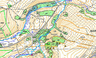
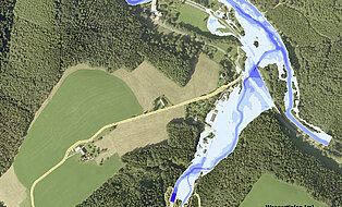
The Free State of Saxony’s state dam administration is planning the construction of an ecologically passable flood retention basin (FDB). This FDB is located in the Biela Valley near the village of Bärenstein in the Ore Mountains. The FDB will retain the floodwater of the Biela, a tributary of the Müglitz. The levee is an internally sealed rockfill dam, 33 m high and 225 m long, for protection against flood events up to 100 year ARI.
For this structure, the project planning and structural engineering were carried out up to the permit approval planning stage. The traffic facilities and the technical equipment were also planned in conjunction.
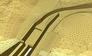
Our geotechnical engineers laid out a concept for the subsoil investigation, carried out a foundation soil assessment, and provided foundation recommendations for the dam and culvert construction. Using 2D and 3D coupled finite element simulations, flows beneath and around the dam as well as the deformation of the levee and the asphalt seal were numerically calculated.
The impacts of the construction project on animals and plants in the sensitive fauna/flora habitat (FFH) were extensively examined and assessed by means of environmental impact assessment (EIA), landscape conservation plan (LCP), and a series of mapping efforts and expert assessments.
A 2D flow model was used to study the discharge and flow behavior of the relief structures and to dimension the water level measurement section in the tailwater of the facility. For verification of these calculations and for the purposes of further detail considerations, a physical model was constructed at the Institute of Hydraulic Engineering and Technical Hydromechanics at TU Dresden. The detail considerations focused on the hydraulic performance of the emergency spillway, the design of the downstream stilling basin and the energy conversion plus hydraulic load on the invert of both the service and watercourse culverts.
Key Data
- Retention area: 2.8 million m³
- Height of structure: 33.25 m; crest length: 225.00 m
- Catchment area: approx. 17 km²; area of study: approx. 1 km²
- Length of Biela: approx. 1.1 km, Length of Müglitz: approx. 1.2 km
- Load cases: MQ, Q3, Q5, Q8, Q10, BHQ1, BHQ2, BHQ3
- Protection objective: Protection against up to 100-year flood
Basic planning services
- Project planning of engineering structures, phases 1–4
- Traffic facilities, phases 1–4
- Structural engineering, phases 1–3
- Technical equipment, phases 1–4
Geotechnical Services
- 2-stage subsoil investigation concept
- Preliminary geological report
- Optical and acoustic borehole scanning
- Water pressure tests and injection tests in consolidated rock
- Soil and rock mechanics testing
- Subsoil assessment and foundation recommendations for the dam and culvert construction
- Verifications of safety, serviceability, and durability as per DIN 19700
- 2D and 3D coupled FE simulations of the flow beneath and around the dam as well as of the deformation of the embankment and asphalt seal.
Environmental Planning
- Scoping
- Environmental impact study
- Technical appraisal under species protection law
- Natura 2000 impact assessments with scrutiny of alternatives and derogation assessment
- Landscape conservation support plan
- Faunistic mapping (mammals, birds, amphibians, reptiles, insects, fish, macrobenthos)
Flow modeling (Hydro_AS-2D)
- Hydraulic verification for spillway, operational outlet, watercourse culvert, and gaging section
- 2D HN model (Hydro_AS-2D) for the planned state of the study area, including the mouth of the Müglitz river
- Data exchange and plausibility check with results from a physical model test
Client
Landestalsperrenverwaltung des Freistaates Sachsen


