
The Informatics division is specialized in developing IT-based methods and solutions for water management and the environmental sector. We combine years of experience with innovative technology.
We advise on the collection and compilation of specialized geodata, and we structure and manage project data to ensure efficient access and to yield informative visualizations and plans. With the aid of numerical models, we calculate the entire hydrologic cycle – from the formation of runoff to flow processes in surface waters – in closed sewer systems and in groundwater bodies. With the aid of effective models, we optimize the hydraulic performance of built structures. Simulations of transport processes such as soil erosion or pollutant dispersal are also among our services. The development and use of geographic information systems and user-specific software solutions round off our profile of specialization.
Cooperation Between Industry and Research
We work closely together with universities and research institutions and implement the latest findings and scientific methods in our engineering practice.

Flash-Flood Modeling and Heavy Rain Risk Management
Towns and communities are threatened by urban flash floods and uncontrolled water runoff. The threat is increasing due to climate change. In heavy rain hazard maps, we identify the specific danger and the actual risks by, for example, identifying…

Suitably Dimensioned Flood Protection
We provide our hydraulic engineers with safety verifications and design flow discharges for flood control retention basins according to DIN 19700 and calculate design water levels for dams, dikes, and flood protection walls. We study the protective…
Hydraulic Parameters for Waterbody Development and Conservation
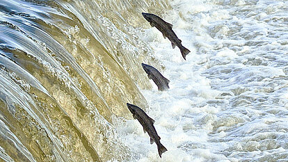
We provide environmental planning support for implementation of the EU’s Water Framework Directive. We calculate the watercourse’s hydraulic loads from discharges according to BWK M3/M7, conduct a hydraulic examination of fishways with regard to…
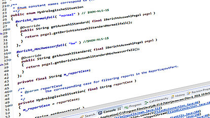
Software and Website Development
Our strength is the development and implementation of customized software solutions for water resources management, the environment, and civil protection. This includes our Kalypso modeling system and KalypsoForecast. For ESRI ArcGIS, we develop…

Surveying
We use both terrestrial and photogrammetric methods to conduct surveys. On site we collect the geodata using mobile connections. Thanks to state-of-the-art equipment, we are able to combine procedures as needed and to conduct surveys quickly and…

UAV Overflights, Photogrammetry
Our view from above. We employ unmanned aerial vehicles (UAV) for photo and survey flights. Our octocopter is guided by GPS and automatically follows pre-planned flight routes. We generate digital orthophotos, 3D point clouds, or digital terrain…
")
Building Information Modeling (BIM)
Our BIM professionals for building construction and infrastructure engineering (certified as per “planen bauen 4.0”) provide interdisciplinary support and guidance on BIM-compliant project execution. From planning and tendering to construction and…

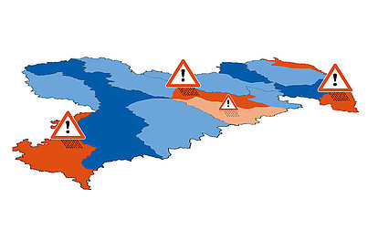
Flood Risk Management
We evaluate the flood risk in river drainage basins for municipalities as well as private and commercial clients on the basis of the European Flood Risk Management Directive (EU FRMD) and we produce flood hazard and flood risk maps, flood risk…
Flood Forecasting
We develop hydrological models and optimize them for flood forecasting (model software: HydPy, Larsim, etc.). For operational use in flood warning centers, we implement the models with Delft-FEWS and our open source development KalypsoForecast. By…

Hydraulic Optimization of Built Structures
To what degree are hydraulic structures subjected to the discharge and flow behavior of groundwater and watercourse flow? We review and optimize the “holistic” hydraulic impact of the structures by carrying out hydraulic (dimensioning) verifications,…

Data Management
Availability, accuracy, relevance, management. We take good care of your data! We give you professional guidance on the selection of suitable data and support you in all tasks from con-version and expert processing to structuring and managing the…

Digital Terrain Models
We create digital terrain models (DTMs). For this purpose, some of the tasks we perform include data acquisition (e.g. with aerial drone, laser scan), manual post-processing of DTMs (e.g. incorporation of built structures, ditch configurations,…